Burke VRE Trail - Pohick Stream Valley
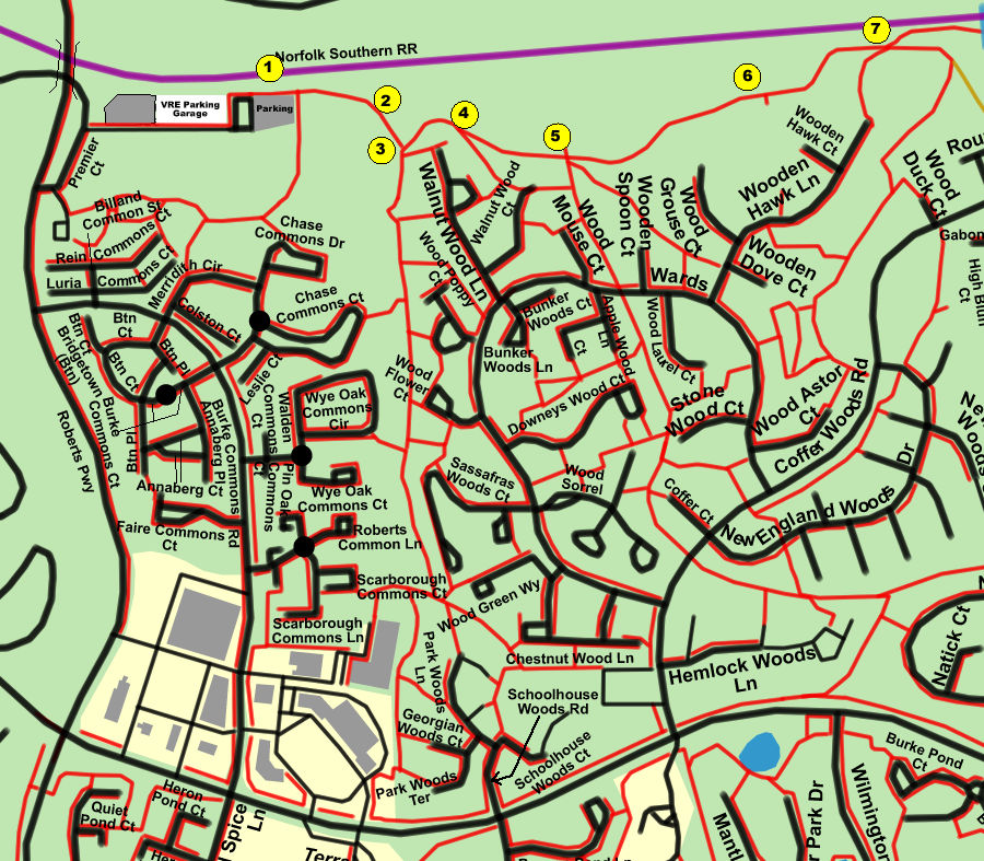
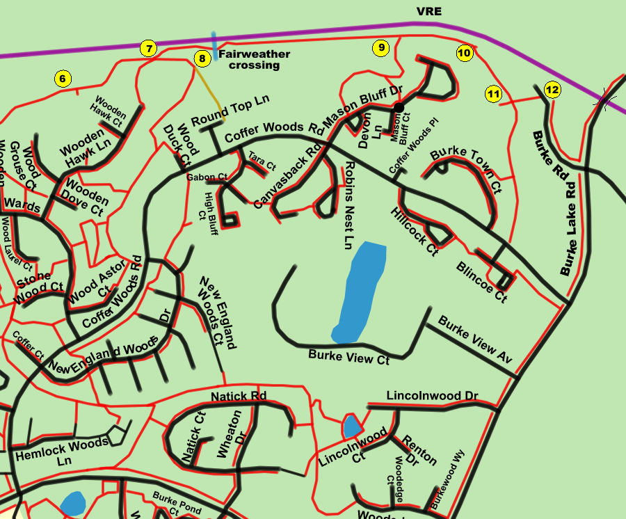
Burke VRE Trail - Pohick Stream Valley
Length: 3.0 miles (round trip)
Surface: asphalt trail with 1 fairweather crossing
Exposure: shade and sun
Surroundings: woods, meadows, streams
This trail ties many developments in northern Burke Centre together and provides walking/ biking access to the VRE station and farmers marker to the west and to the shopping centers along Burke Lake Road to the east. Future plans call for expansion to the east along the Pohick Creek from Burke Lake Road.
Click here for trail map and directions in pdf format for printing.
Click here for a Google Map showing the Burke VRE Station location. Use this map to obtain driving directions to the start of this walk.
You will need Adobe Reader to print the map in pdf format. Click here to proceed to the Contents Page for a link to this free software.