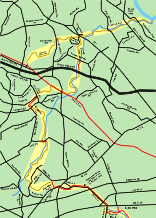
Fairfax Cross County Trail - Northern Section
Click on any trail section to view detailed map.
Fairfax Cross County Trail
Fairfax County is building a cross county trail system that will connect Great Falls Park to the Occuquan River near Route 123. This map provides a view of the trail system from Great Falls Park to Thaiss Park near Fairfax City. After viewing the system map above click on one of the sections to see a detailed map of that section. Written directions and pictures are provided for most of the sections.
Note that a horse trail linking the W&OD Trail to the Cross County Trail near Colvin Run Mill is also shown on this map. This can provide an alternate route between these points. It is also possible to use this as part of a loop walk without retracing your steps.
Central Section Key Map
Southern Section Key Map
Cross County Trail General Information
