Buttermilk Creek
Aerial view of trail area
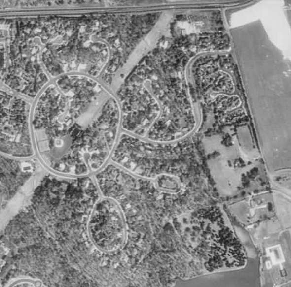
Aerial photo dated 1994 courtesy USGS.
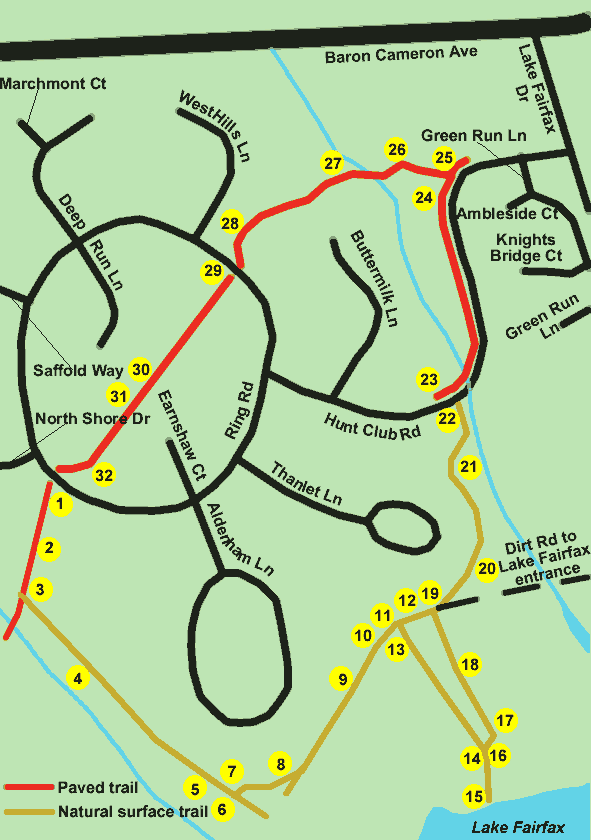
Buttermilk Creek Trail
This walk actually extends beyond the Buttermilk Creek Trail in order to provide a complete loop trail of the area.
Length: 1.3 miles without Lake Fairfax detour
Length: 1.6 miles with Lake Fairfax detour
Surface: Natural surface and paved trails
Exposure: shade and sun
Surroundings: woods, fields, homes, streets
Directions:
This walk starts at the Uplands Pool at North Shore Drive and Ring Road.
- Take the asphalt trail to the left of the pool down through the pipeline right of way.
- The trail goes down hill to the left and enters the woods.
- Turn left on the first dirt trail to the left. A large sign will mark the trail. Place your mouse over the picture of the sign to see the start of this trail.
- The trail crosses a culvert. Look for the next culvert crossing.
- The trail crosses a second culvert. Look for wooden steps to the left just up ahead.
- A trail appears to the left with wooden steps. Go up these steps and turn right to follow the path.
- A power transformer to the left will confirm you are still on the path.
- The trail intersects with another dirt trail. Turn left.
- The trail goes down hill. Note how the trail follows numerous fences such as the one shown.
- After crossing a gully the trail starts back up hill.
- Just prior to a clearing a wide trail appears on the right. This trail can provide a view of Lake Fairfax. If you wish to view the lake on a relatively short trail turn right. Go to point 13 to start the detour to Lake Fairfax.
- If you have chosen not to detour to Lake Fairfax proceed through the clearing staying to the left. You will be turning on the other side of the clearing. Your next point on the map will be point 19.
- The path to Lake Fairfax remains level as it heads through the trees.
- It comes to a hill overlooking Lake Fairfax. You will get a better view by walking down the hill. When finished come back up to this point.
- This is a view of the Lake Fairfax dam from the bottom of the hill.
- After going back to the top of the hill in photo 14 follow the wheel tracks north into a clearing. If you have walked up the hill the path will be to your right.
- The path enters a clearing after a very short distance. Continue to follow the wheel tracks to the left of the big tree in the center of the clearing.
- After passing the big tree follow the tracks towards the right of the clearing. At the end of the clearing you have rejoined the trail that you detoured from.
- The detour to Lake Fairfax rejoins the original trail at this point on the edge of the clearing. Take the narrow trail to the left along the fence. Do not take the wheel tracks down the hill, which lead to the entrance to Lake Fairfax. If you encounter gravel fill on the trail you have taken the wrong path. Note the post with an arrow in the photo that points to the correct trail. Since marker posts have a habit of disappearing dont count on the post to confirm the trail.
- This wooden bridge will help to confirm that you are on the correct trail. Also, notice that you are following a stream to the right with houses on your left.
- The trail passes another culvert. This culvert simply serves as a landmark to confirm that you are on the trail.
- The trail climbs stairs to reach Hunt Club Road.
- Cross Hunt Club Road and take the sidewalk on the other side to the right. Hunt Club Road divides up ahead.
- Hunt Club Road turns to the right. Look for an asphalt path to the left. It is just prior to the white mailbox in the photo.
- Follow the asphalt path between the houses.
- The trail crosses 2 bridges.
- The trail curves up hill back into the pipeline right of way.
- The trail curves to the left of the field and crosses Ring Road.
- The trail continues on the other side of the road to the left of the play equipment.
- The trail passes a basketball court on the right.
- The trail passes a baseball field on the right.
- The trails goes down hill, curves to the right, and returns to the starting point at Uplands Pool.